From small pieces to holistic vision: The Great River Park Master Plan charts a course for St. Pauls riverfront
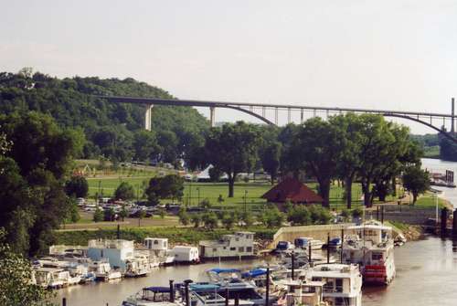
Across from downtown, Harriet Island acts as St. Paul's central gathering space.
Photo: Bob Spaulding/FMR
With the help of community members throughout the city, the stage is being set for St. Pauls riverfront to be transformed from a series of disconnected redevelopment and conservation efforts into what planners hope will amount to an integrated rebirth. Through a series of recent public meetings, the Great River Park Master Plan has begun to take shape.
The Great River Park is the overarching name for the citys current and future riverfront parkland, including such well-known parks as Harriet Island, Lilydale, Crosby Farm, Hidden Falls, Pigs Eye and the Bruce Vento Nature Sanctuary, as well as a number of other smaller park spaces and connecting trails.
To many, this discussion has been the logical next step in an ongoing conversation. This process is a continuation of so many years of effort on the part of so many people that have really believed in the vision and the power of the river, said Mayor Chris Coleman at the projects opening ceremony.
The City of St. Pauls adopted framework for the process emphasizes three guiding principles: to create a riverfront park that is more natural, more urban and more connected. The project launched in August and included a series of six public workshops this fall. Hundreds of members of the public have provided detailed input into the nature of improvements they think could be incorporated into the realization of a cohesive Great River Park.
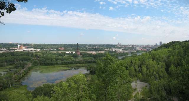
The expansive Lilydale Park and Pickerel Lake (foreground) is just upriver from Harriet Island, and is a favorite refuge for area residents and an increasing diversity of wildlife.
Photo: Whitney Clark/FMR
A few consistent themes have emerged throughout the planning process. One is a discussion around how to better connect various riverfront park spaces some portions of the river have a continuous integrated riverfront roadway, parkway and trail system while others, like parts of the West Side or Highwood Hills, do not.
In addition to connections along the river, one of the most unique and persistent challenges facing St. Paul is how to better connect the river with most neighborhoods. The bluffland topography of St. Paul is one of its most distinctive features, but throughout the corridor the bluffs steep drop pose a persistent impediment to bringing people to and from the river. Addressing the issue requires creativity and sometimes significant resources whether that means replacing the iconic green stairs of the West Side or building more vertical connections such as those integrated into the Science Museums bluff-side in downtown.
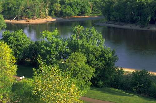
Crosby Farm Park, across the river from Pike Island and Fort Snelling, is a popular hiking destination.
Photo: Courtesy of the National Park Service
Throughout the process, participants grappled with the appropriate types and uses of the riverfront parks at various points along the river where might we work to add a new riverfront restaurant, adventure sports facilities, or an outdoor recreation hub and information center? Likewise, participants wrestled with the appropriateness of other current (sanctioned or otherwise) and potential uses such as what, if any, locations could accommodate additional dog parks, cave exploration, or off-trail biking facilities?
Finally, one of the key efforts of the project is to determine, the intensity of usage at various points along the river. The St. Paul riverfront includes many likely redevelopment sites from the West Side Flats across from downtown to the historic Island Station power plant near Shepard Road and Randolph Street. The process can help guide the character of the redeveloped riverfront whether on public or private land.
In addition to looking to citizens and other stakeholders for input, the city is looking to those who have been part of the process to help bring the plans to fruition. Weve had so many folks who have been part of this effort, Coleman said, and so many people will need to continue to be involved to keep that vision alive.
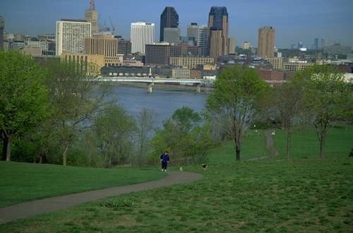
Mounds Park offers iconic views up and downstream, along with the historic Native American burial mounds for which the park is named.
Photo: National Park Service
The process is being managed by the St. Paul Department of Parks & Recreation, and has been led by two principal consultant groups - Denver-based Wenk Associates and their local project partner Minneapolis-based Hoisington Koegler Group. The consultants plan to use the input gathered at the community sessions to refine a more comprehensive and formal final draft plan, which will be the subject of further community discussions in early 2011.
For more information, or follow the work of the group in detail, visit greatriverpark.org.
Bob Spaulding, River Planner